

Višňovská dolina:
It is located approximately 10 km from Žilina and is embedded in the Lučanská Fatra mountain range . Just a short distance next to Turská dolina. It is often visited for its climbing terrains, which also include one of the most difficult climbing walls in our country - the " Panter 8b+ " route. a via ferrata on Hoblík (933.6 m above sea level) . There are several sources of drinking water in the vicinity. The spring springing directly in the village of Višňové is often visited by local residents to collect spring water. There are several fireplaces in the Višňovská dolina, but local legislation must be respected and the principles of grilling must be followed in order not to cause a fire. In general, setting fires in nature is prohibited and fires can only be set in places designated for this purpose, such as public fireplaces and campsites.
A forest road leads through the Višňovská valley with a slight incline to Chatá pod Holý dielom , where there is a fireplace and benches. There is also a well , where we can get drinking water and a signpost . From here, the hiking trail to Minčol leads past the ski lift. A popular New Year's Eve ascent to Minčol to a height of 1,346 meters above sea level. Information about the ascent can be obtained at the turn of the year on the website of the village of Višňové . Back to Višňový we can choose a steeper but shorter route, where we will be accompanied by a view of the striking Hoblík hill . Despite the fact that the surrounding environment has a well-preserved impression, intensive logging , which cannot escape our attention. It is therefore necessary to believe that the institutions and conservationists have this area firmly in their hands and know what is needed to maintain this exceptional natural location for future generations.

 Map of the Višňovská dolina location:
Hotspots
![]()
| Download route | Info | |
| Route for the Locus map application, Google Earth | .kml | |
| Route for Mapy.cz | .gpx | |
Photo gallery:


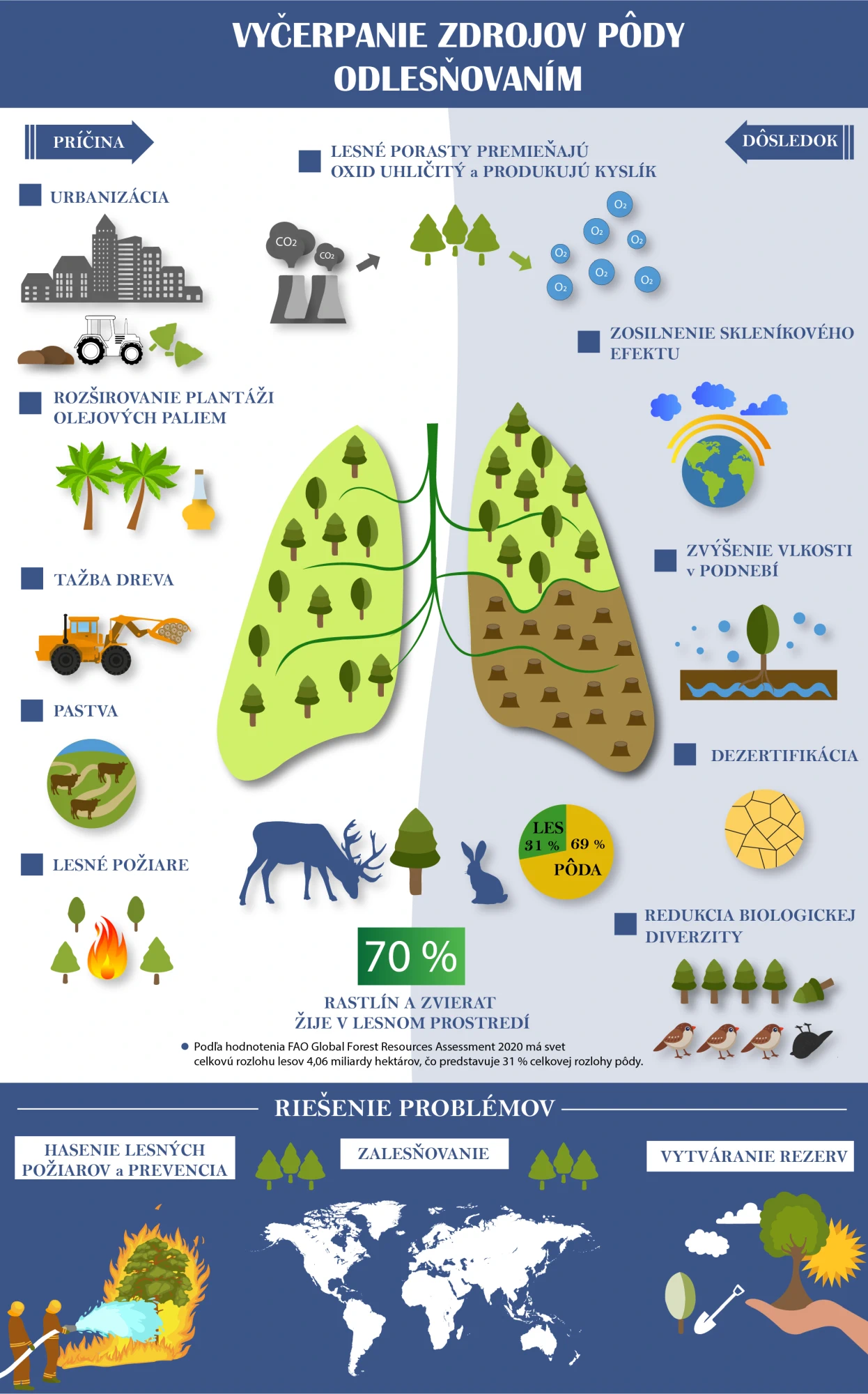
Infographic - Depletion of soil resources:
CONTENTS:
Contribute to the discussion with your observation, photo of this location: